背景
关于shp数据的坐标转换问题,在上一篇博文中其实已经提过,但是语焉不详,估计难以看懂,所以特此补充一篇详细的转换过程博文,以供参考。
坐标转换过程中用到了‘使用ArcEngine移动Feature’的技术,受ArcEngine限制,该过程执行效率并不高,三万条数据大概处理了15分钟。此处提出一点建议:
可将移动polygon的操作另起一个线程进行,这样可以避免与主线程(绘制界面)竞争资源,提高执行效率,也避免了界面卡住。
实践过程
以下实践以polygon shp为例,个人认为polygon的坐标转换要比point和line难,所以以此为讲解素材。
- 在Arcgis中打开shp数据,并为shp数据添加x,y坐标属性(即添加图形要素的中心点坐标),具体操作如下:

- 右键点击table of contents中的图层,选择open attribute table,再点击如图所示按钮,选择Add field

- 弹出对话框按照如下填写,注意圈出部分,点击ok

- 同样的操作添加Y字段,结果如下:

- 右键点击X字段,选择Calculate Geometry

- 注意下面圈出两项的一致性

- 同理计算Y的坐标值

- 结果如图

- 接下来,使用ArcgisEngine开发包,解析shp并修改其数据,完成纠偏。代码如下:
private void movePolygon()
        {
            IMovePolygonFeedback m_MovePolygonFeedback = new MovePolygonFeedbackClass();
            IFeatureLayer pFeatureLayer = axMapControl1.get_Layer(0) as IFeatureLayer;
            IFeatureCursor pFeatureCursor;
            pFeatureCursor = pFeatureLayer.FeatureClass.Search(null, false);
            IFeature pFeature = pFeatureCursor.NextFeature();

            IWorkspaceEdit workspaceEdit;
            IWorkspace workspace;
            IDataset dataset = pFeatureLayer.FeatureClass as IDataset;
            workspace = dataset.Workspace;
            workspaceEdit = workspace as IWorkspaceEdit;
            //开始编辑(会开启一个session,消耗资源)
            workspaceEdit.StartEditing(true);
            workspaceEdit.StartEditOperation();

            while (pFeature != null)
            {
                int xidx = pFeature.Fields.FindField("X");//需与shp属性表中的字段对应起来
                int yidx = pFeature.Fields.FindField("Y");
                double x = pFeature.get_Value(xidx);
                double y = pFeature.get_Value(yidx);
                Console.WriteLine("原坐标:" + x + "_____" + y);
                IPoint preLocation = new ESRI.ArcGIS.Geometry.PointClass();
                preLocation.PutCoords(x, y);
                m_MovePolygonFeedback.Start(pFeature.Shape as IPolygon, preLocation);

                double[] convertLocation = projConvert.wgs84togcj02(x, y);
                Console.WriteLine("纠偏后坐标:" + convertLocation[0] + "_____" + convertLocation[1]);

                //修改xy字段值,改为纠偏后值
                pFeature.set_Value(xidx,convertLocation[0]);
                pFeature.set_Value(yidx, convertLocation[1]);

                //移动对象到当前位置
                IPoint desLocation = new ESRI.ArcGIS.Geometry.PointClass();
                desLocation.PutCoords(convertLocation[0], convertLocation[1]);
                m_MovePolygonFeedback.MoveTo(desLocation);

                IGeometry resultGeometry = m_MovePolygonFeedback.Stop() as IGeometry;
                pFeature.Shape = resultGeometry;
                pFeature.Store();
                pFeature = pFeatureCursor.NextFeature();
            }
            //结束编辑
            workspaceEdit.StopEditOperation();
            workspaceEdit.StopEditing(true);

            m_MovePolygonFeedback = null;
            MessageBox.Show("完成");
        }
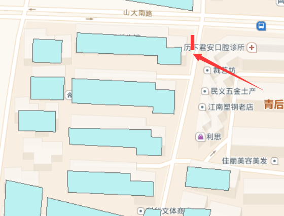
- 结果如图所示:

后话
此处仅仅是移动了shp数据的要素位置和修改了要素的坐标数据,并未在Arcgis中对其定义的投影坐标系进行修正,但经过检验,不影响数据的叠加使用,在修改投影坐标系方面如有需要,请自行搜索,网络上教程很多。
有时间会补充上openlayers加载高德地图叠加修正数据的例子。